The Russian Arctic in Focus: Why Study the Northern Sea Route and the Communities along Its Way
Olga Povoroznyuk
On October 11, 2021, the Russian government announced its ambitious goal – to provide year-round transportation on the Northern Sea Route within the coming two years.
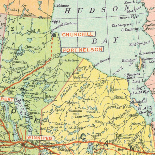
The Northern Sea Route (NSR) is Russia’s largest Arctic maritime transport infrastructure. In the past, it brought to life a number of coastal communities and triggered the construction of sea ports. During the Soviet period, it played a tremendous role in the transport of resources and community supplies, primarily within the country.
While it has retained some important domestic functions, the reason for global attention is its international potential, seen by some as a future alternative to the Suez Canal. Furthermore, melting sea ice coupled with Russia’s programs of infrastructural modernization, securitization, and economic development in the Arctic, make the NSR a topic of hot geopolitical debates and tensions.
But what is the actual role of the NSR in the regional development of the Russian Arctic today? And what does this mega-infrastructure mean to local communities?
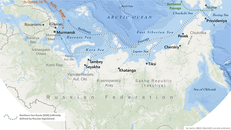
The Russian Arctic coast stretches from Murmansk in the Barents Region in the west, to Northern Yamal, to Taimyr, to Northern Yakutiya, and to Chukotka and the Bering Strait in the east. Actual impacts, as well as discourses, promises, and expectations tied to the NSR have been shaping the pasts and the futures of coastal communities.
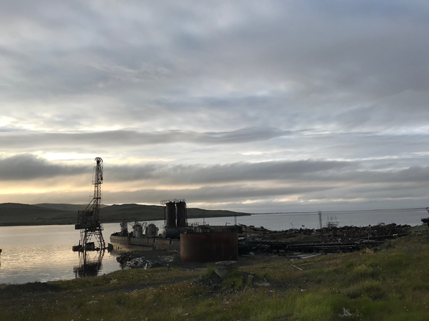
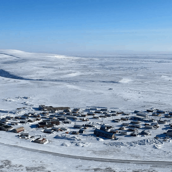
Most of the present-day NSR settlements reveal a strong socio-economic and infrastructural path-dependence on the Soviet past. As they were designed and built with the consideration of different, significantly larger population numbers than the current ones, abandoned and often decaying infrastructures (houses and other buildings, ships and boats or parts thereof) dot local land- and seascapes.
In contrast to the Soviet past, there is currently a greater diversity of stakeholders standing behind the development of the NSR and its communities.
Now it is not only the state, but partnerships between the state and companies with a large share of private investments, which stand behind the modernization of sea ports and the (re)construction of houses, airports, roads, and railroads.
On the one hand, current socio-economic and infrastructural development along the NSR and beyond is driven by resource extraction and international trade. And, on the other hand, it is constrained by the growing securitization, militarization, and isolation of communities, especially, those belonging to the militarized border zone like Tiksi.
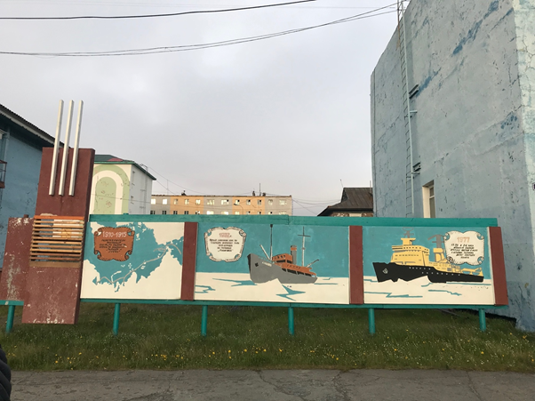
These trends create specific socio-economic and demographic dynamics on the local level. The community of Tiksi, founded as an NSR port in the heyday of Soviet exploration of the Arctic, illustrates the changing role of the NSR. While up to the 1980s this maritime route and the sea port provided Tiksi with a wide assortment of goods not seen in other parts of the country and attracted new residents, currently it plays a limited role in terms of community provisioning and state investments.
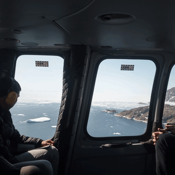
Most of the goods and materials are supplied to Tiksi by winter roads or boats on the Lena River. Airplanes and boats facilitate passenger mobility within the country and the region respectively. While the national NSR program is in full swing, communities see little socio-economic impact from these developments. Often, the plans of infrastructural modernization exist only on paper and remain unfulfilled promises, and the benefits from the exploitation of the NSR do not seem to reach the local level.
While local residents emphasize the historical significance of the NSR for community development, their expectations from its modernization program are rather low. To cite the words heard in the local administration: “Well, the Northern Sea Route … I am glad for the country that it exists, but as a municipal employee, I don’t see myself as part of it.”
In a similar vein, hopes that developments along the NSR will secure stability and well-being of Tiksi, are vague. Interestingly enough, some local residents would rather associate the future of their community with the recent repopulation of the military base located a few kilometers away from the civilian district of Tiksi that had been abandoned after the dissolution of the USSR.
The Russian Arctic is the largest and most industrialized part of the Arctic.
Historically, the NSR has been playing an important role in the industrialization and urbanization processes, as well as transportation. While this marine transport route may not become a viable alternative of the Suez Canal in the near future, it can facilitate mobility, connectivity, and exchange on the pan-Arctic scale.
Most importantly, the NSR is a powerful imaginary, recently shaped by mass media campaigns surrounding the national modernization program of the NSR. In the long run, its actual social impacts will depend on investments in transport, urban, and other critical infrastructures and on jobs created for local communities.
The Russian Arctic, as the largest study region of the InfraNorth project, will encompass up to eight field sites between Murmansk and Provideniya. They will provide comparative ethnographic material that will help us to explore the multifaceted entanglements of local communities with the NSR and other transport infrastructures from the perspective of those who live, work, and travel in this region.

Please login to post a comment...